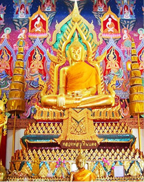

History
Samut Sakhon, is a seashore province located at the Tha Chin River. From historical evidence says in the Ayutthaya period, there is a large community located in Gulf of Thailand. The Chinese brought a lot of junks into the harbor for trade and residents so-called "Baan Tha Chin" During the reign of Emperor (2099 BC), please raise "Baan Tha Chin " to "Sakhon Buri City" to districts for the mobilization for war and as the outpost city to prevent enemy invasion by sea. Later in the Rattanakosin period, King Mongkut Rama 4 gave them renamed from " Sakhon Buri City " to "Samut Sakhon City", which means that "City of the sea and the river". In the reign of King Rama 5 (2448), administrative reform has new organized administrative system, The Provincial Administration as monthon. And had the initiative to create prosperity for the local area by using form of government sanitation. He has been raised "Tha Chalom" to "Sukhapiban Tha Chalom" on March 18, 2448. It held that "Sukhapiban Tha Chalom" is a first districts in Thailand
Later in the reign of King Rama 6 (2456), government changed the word "city" be a "province" all over the kingdom. " Samut Sakhon City " was renamed "Samut Sakhon Province" From then to the present
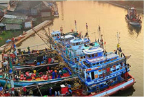
The word "Mahachai" that people prefer to call. It is the canal named after the King of Ayutthaya Sanphet 8 please to dig a canal as shortcut from the Thonburi City straight out to estuary of Sakhon buri City for Khonburi instead winding Khok Kham Canal. But not completed before he died. Until the reign of King Sanphet 9 (Kunhlwg Tai Sa) Please let the dig a canal was completed called Mahachai canal. Later, at the left bank of canal has the large community name "Mahachai".
Administrative Region
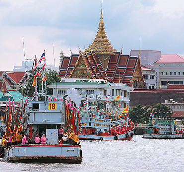
Samut Sakhon, is a seashore province located along the banks of the Tha Chin River in the central part of Thailand. Approximately 130 degrees north latitude and 100 degrees east longitude at a metropolitan province. From Bangkok City by the National Highway No. 35 (Rama 2) of about 30 kilometers. An area of 872,347 Rai. The border as follows.
North: connect to Nakhon Pathom
South: connect to the Gulf of Thailand
East: connect to Bangkok
West: connect toSamut Songkram and Ratchaburi
 30/1 Moo 2 Chetsadawithi Road, Khok kham, Muang,
 (66)034 452-222